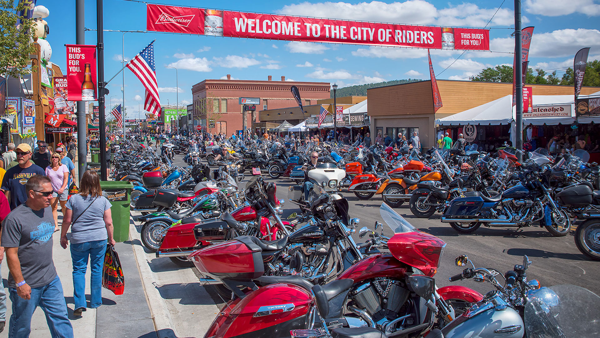
South Dakota Motorcycle Laws Black Hills Visitor Magazine·July 8, 2020With the Sturgis Motorcycle Rally fast approaching, the Black Hills is bracing for the annual onslaught of bikers from across...LearnMaps/Driving InfoSturgis Rally·0 Comments·0
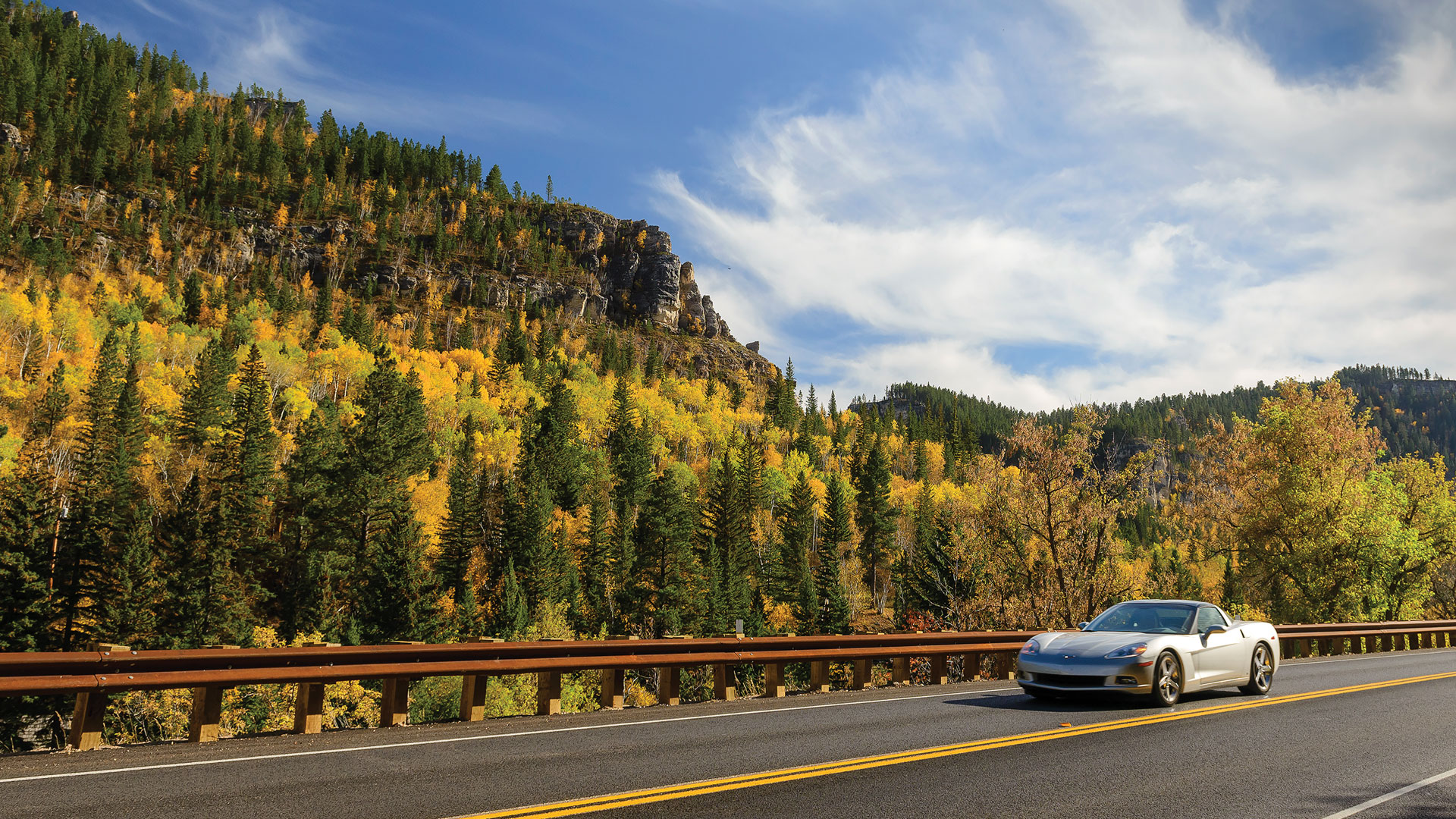
Fall Foliage Hot Spots Black Hills Visitor Magazine·September 18, 2019With autumn just a few days away, it’s time to prepare for the change in seasons. For some...1-DayItineraryMaps/Driving InfoPlan·0 Comments·0
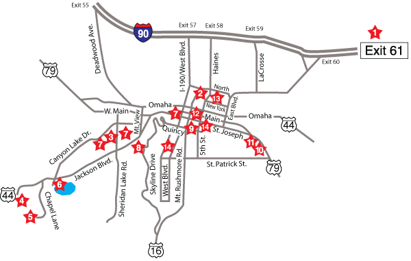
Rapid City’s City Tour Historic District Black Hills Visitor Magazine·September 23, 2016Signs are conveniently located along the way to guide visitors from one point to the next for an...Family AttractionsMaps/Driving InfoPlanRapid City·0 Comments·0
Mileages to the Black Hills Black Hills Visitor Magazine·October 10, 2015Aberdeen, SD 331 miles Hot Springs, SD 57 miles Badlands, SD 75 miles Keystone, SD 21 miles Belle...Maps/Driving InfoPlan·0 Comments·0
Arriving From The North Black Hills Visitor Magazine·October 10, 2015Southeast from Little Bighorn Battlefield National Monument, MT on U.S. Highway 212 The infamous 1876 Battle of the...Maps/Driving InfoPlan·0 Comments·0
Arriving from Interstate 90 Black Hills Visitor Magazine·October 10, 2015Westbound from Chamberlain on I-90 As you leave Chamberlain, the landscape begins to change. After crossing the Missouri...Maps/Driving InfoPlan·0 Comments·1
Along The Way Black Hills Visitor Magazine·October 10, 2015Enjoy The Entire Experience Half the fun of coming to the Black Hills is getting here. Click Along...Maps/Driving InfoPlan·0 Comments·0
Car Rental, Bus Depots, and Airports Black Hills Visitor Magazine·October 10, 2015AAA 815 St. Joseph Street Rapid City, SD 605-342-8482 Belle Fourche Municipal Airport North Highway 85 Belle Fourche,...Maps/Driving InfoPlan·0 Comments·0
Arriving from the South Black Hills Visitor Magazine·October 1, 2015Northbound from Cheyenne, WY on Interstate 25, U.S. 20, and U.S. 85 Today’s routes from Cheyenne to the...Maps/Driving InfoPlan·0 Comments·0